


Down the River
From Seki to Yokkaichi along the Tokaido old road

Seki (the name literally means barrier or gate), has one of the best-preserved old Tokaido streets along the entire length of its route. Unfortunately, I somehow miss it. I had ended my walk to Seki in darkness, and with a desperate rush to get a train back to Kobe. I still had no Tokaido guidebook, which would have informed me of what I was missing, and therefore decide to walk from Seki station to the Tokaido via the main road, which totally misses the renji-mado (wooden lattice windows) and gun-metal grey tiles of the old post-town road.
Hiroshige’s print of Seki shows yet another daimyo procession about to depart from their lodgings. A lot of Hiroshige’s prints show these processions, and illustrate how important they were for the development of the Tokaido. The Sankin-Kotai system meant that the daimyo themselves had to spend alternate years in Edo (now Tokyo), and their families would have to be in Edo while they were back in their fiefdoms. Essentially, either the daimyo or his family were always under the control of the Shogunate in Edo, and this made it difficult to start rebellions back in their distant territories. The financial burden this imposed on the daimyo families (about a quarter of their annual income) also made it difficult for them to raise any kind of rebellion. The daimyo had to retain their image, both in Edo and during their travels, necessitating a large mansion in Edo and a large retinue of servants for the mansion and during their travels to and from the centre of Shogunate power.
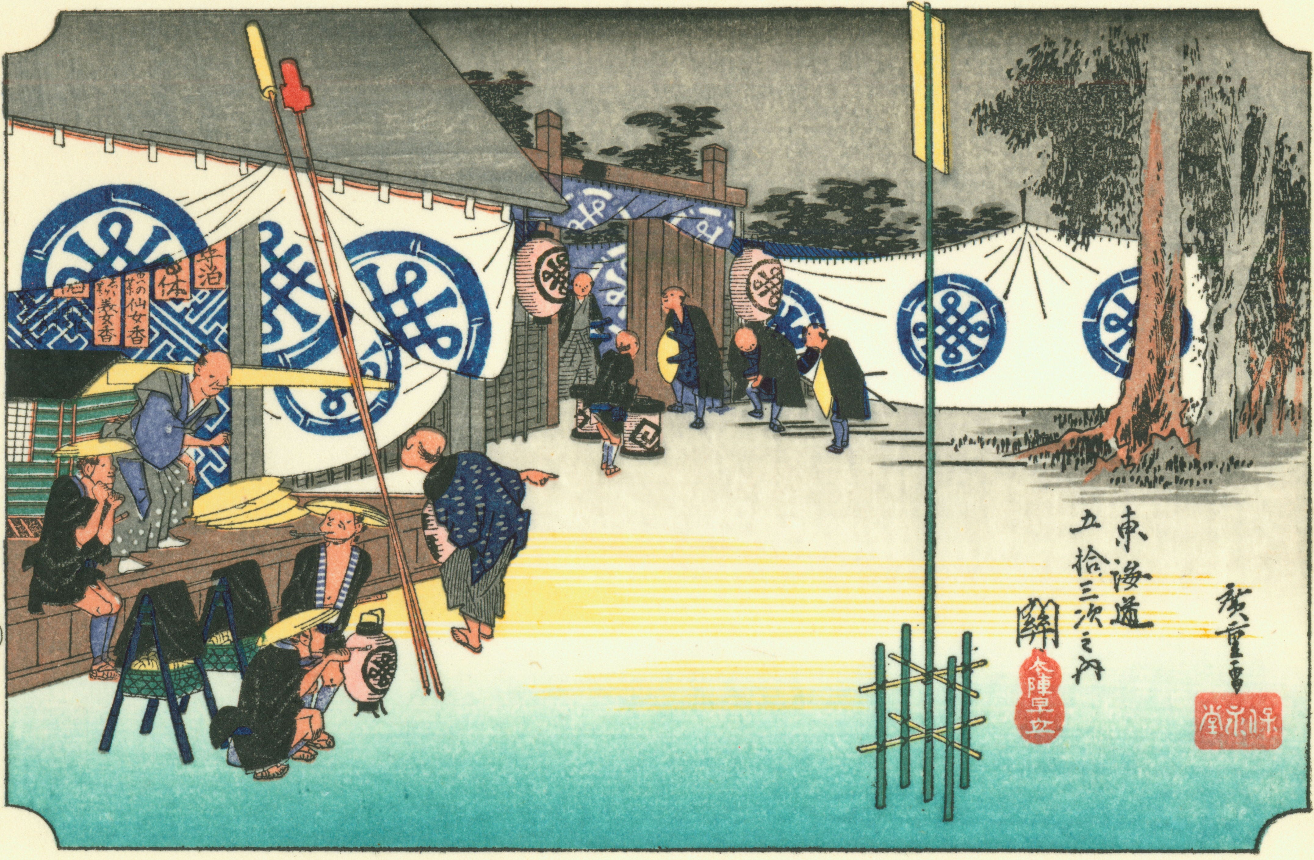
It is part of this retinue of servants we can see about to depart Seki in Hiroshige’s print. The lavish banners with the family crest of the daimyo family can be seen adorning the honjin (the main hall where the daimyo families would stay in each shuku rest stop). You can see how early the retainers are rising from the dark sky with a single star still visible. All the poles and banners you can see in the print would have had to be carried to the next resting place, and with nothing in the way of horse-drawn carriages, the daimyo procession was a feat of logistical planning. There was a fixed schedule to when each daimyo procession was moving along the roads to Edo, so as not to overburden the facilities in each shuku as they passed.
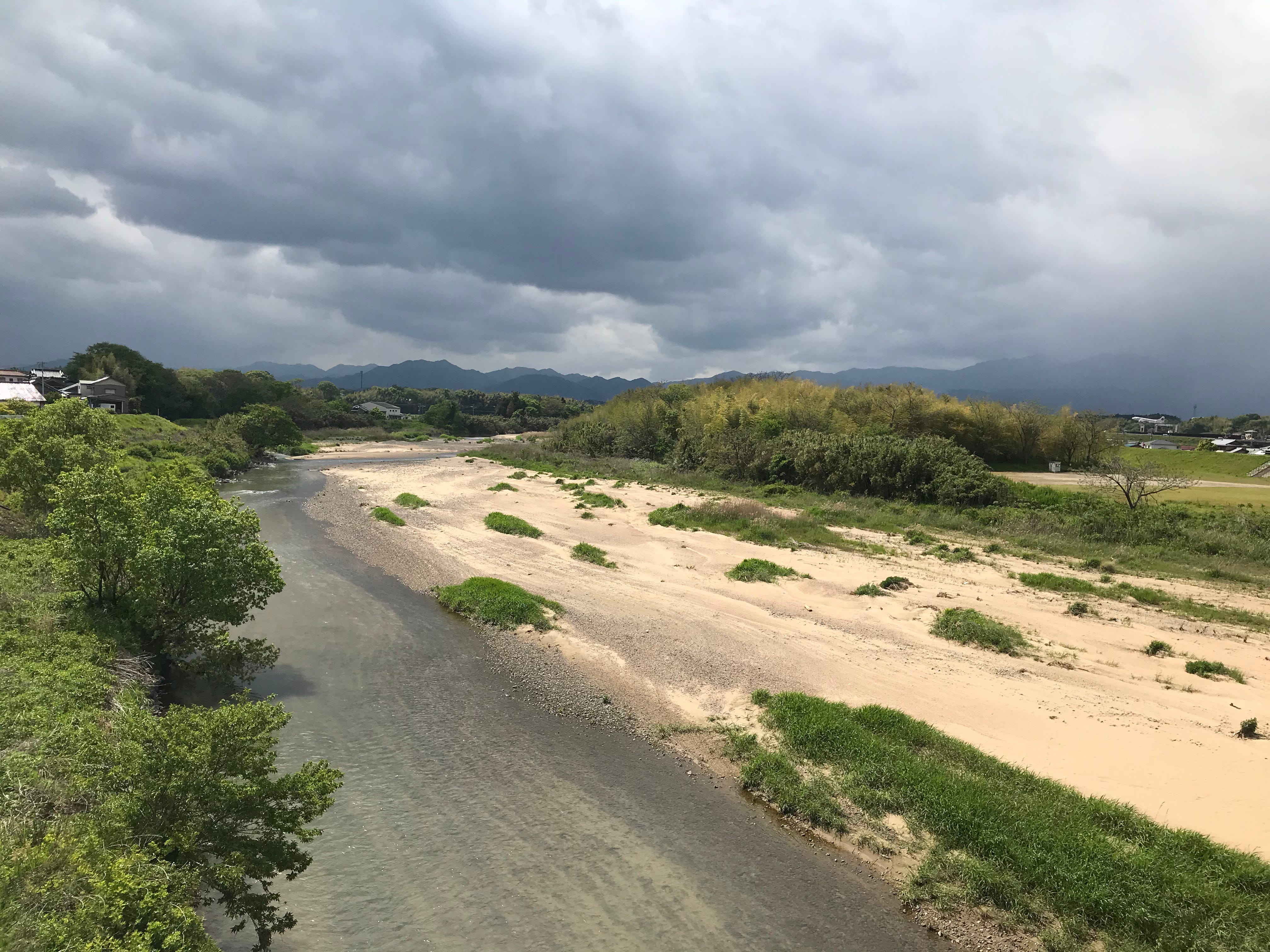
As I leave Seki, my route takes me alongside a thin strip of farmland by the Suzuka river. With the river to my south, the ridgeline of mountains widens out to reveal Kameyama Sunshine Park to the north. Not, as you may imagine, a park to relax and enjoy the sunshine with your family, this is an industrial park, containing Sharp’s Kameyama plant. While Japan’s car industry has weathered the last few years remarkably well, the same cannot be said for Japan’s electronics industry. Both Daihatsu (on the other side of the Suzuka pass, north of Koka) and Honda (on this side of the pass in Suzuka, where the Japanese Grand Prix is held) have held their own, remaining highly competitive car makers. Sharp, however, dived in a big way into LCD TVs, before intense competition from South Korean rivals and changing technology forced them to switch to making mobile phone screens. The Kameyama plant would begin churning out LCD TVs in 2004, and its Aquos brand TVs would become famous around the world. By 2009 however, things had taken a turn for the worse. Huge investments in LCD production by both Sharp and their South Korean rivals led to a drop in the price of LCD panels. It seemed unlikely that Sharp could recoup its investments in production lines in places like Kameyama. By October 2012, Sharp had decided to cut its LCD TV output at Kameyama, and instead shift production to mobile phone screens. In 2016, Sharp was acquired by the Taiwanese company Foxconn, and the Kameyama plant’s shift to production for mobile phones was accelerated. In 2018, the Kameyama plant indirectly laid off about a thousand “foreign workers of Japanese descent”(i.e. Nikkeijin) according to the Mainichi newspaper.
The Tokaido wiggles its way up and down the side of the valley above the Suzuka river. In the village of Nomura, I pass one of the few remaining ichirizuka marker mounds. There would originally have been one of these marker mounds on each side of the road. They are the milestones of the Tokaido, each ri being about 4 kilometres or 2.5 miles apart, and were crowned with trees. Nowadays, there is often only one very old, twisted tree remaining on the top. These markers were used to calculate the fares for carrying goods by kago (basket), or people by palanquin. They were numbered to calculate the distance from Edo, the centre of real power, rather than the distance from Kyoto, the official capital.
Finally, I reach the town of Kameyama via a pleasant approach across a narrow, bamboo-lined valley, before climbing the steep slope to the castle town on the other side. As I look down into the valley, I wonder if I could sleep there. I’m on the lookout for places to bivvy. Now I’m so far from home in Kobe, it’s becoming increasingly expensive, and difficult, to take the train back and forth from the hikes every time. So, I’ve invested in a bivvy bag and a sleeping mat, after much internet research to find appropriate items. I don’t want a full-scale tent that will attract attention and be difficult to put up, but nor do I want my face exposed to the elements all night, so I compromise on a bivvy bag with a single flexible pole to hold the material away from my face. I’m guessing it will be like sleeping in a coffin, but I don’t mind that too much. What worries me is where I will sleep. Wild camping is technically illegal in Japan, just like England and Wales, but is tolerated as long as you don’t cause any trouble. Homeless people typically make their blue tarpaulin and crate-wood shelters next to rivers, so these seem to be widely tolerated places for wild camping. This riverside looks too narrow, and there are gardens down in the bottom, it doesn’t look like I could get away with camping here. I’m going to need a wider river.
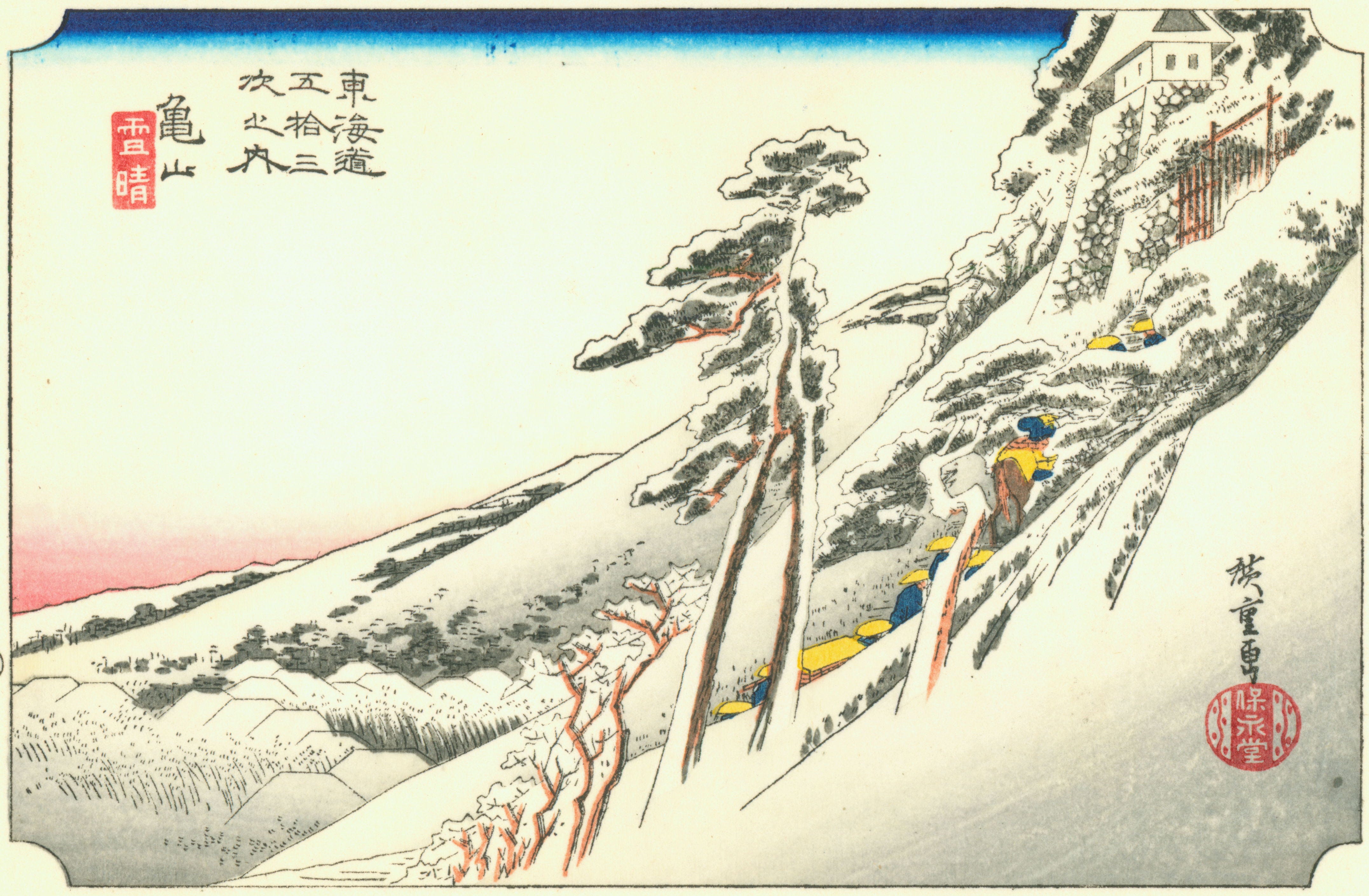
Hiroshige has a print of a daimyo procession making its way up to Kameyama castle and its accompanying shuku. His depiction shows the procession in the middle of winter, climbing the snow-covered slopes of leaning pine to the stone walls and wooden gate of the castle town. The weather for me is lush, late-spring, almost English summer type weather. Sunny and warm, but enough clouds around to give the impression there could be showers. It’s one of the few places along the Tokaido where the scenery hasn’t changed much since Hiroshige’s time. True, the castle has gone, and there are only the ruins to explore at the top, but the basic features of the scenery remain, the steep slope up from the valley, with the town at the top.
I potter about the castle ruins for a while, then carry on through the town of Kameyama. The reason why there are only ruins, is not due to the ravages of some war (including World War 2), like lots of other Japanese castles, but due to a place name error. In 1632, the shogunate ordered the reconstruction of the keep at Kameyama Castle, presumably to help strengthen control over the area around the castle. Unfortunately, the shogunate meant another Kameyama Castle in modern Hyogo prefecture, near Tamba. By the time the error was realised, the keep at this Kameyama Castle had been pulled down, and the shogunate didn’t let the local daimyo rebuild the castle keep.
By the time I leave Kameyama, I can feel I’m close to the sea. There’s something about the flatness of the land and something about the freshness of the air that suggests I’m closer to the sea than I’ve been since the start of the Tokaido. And indeed I am closer to the sea, it’s now just a short river ride away.
At the point where the Tokaido crosses Route One, there’s a Brazilian evangelical church in a converted restaurant. We’re very close to Honda’s Suzuka factory now. I meet the Anraku River, just before it meets the Suzuka River, whose course I’ve been following since the Suzuka pass. On the far side of the river, I can see an aeroplane in the shimmering distance. Is there an airport? I don’t think there’s one near here. It looks like a gate guard for an aerodrome, I want to find out why it’s there. But it’s too far out of the way, and I leave it to Google Earth to figure out later. (It turns out to be in a metal scrapyard, an advertisement perhaps?)
Anraku River - The scrapyard YS11 aircraft is on the far right of the picture
The riverside dykes along the Suzuka, and the accompanying sluice gates and weirs, give the area an East Anglian fenland feel. Then the Tokaido is severed by the intersection of Route One and another big road. I have a choice - under Route One through a tunnel with no pavements at the side - or try to cross Route One itself up a ramp also without pavements. I spot a third option though, and duck through a small tunnel under Route One designed for drainage and farmer access. On the other side, there’s a damp field edge I squeeze along until I make a wide pavement alongside Route One.
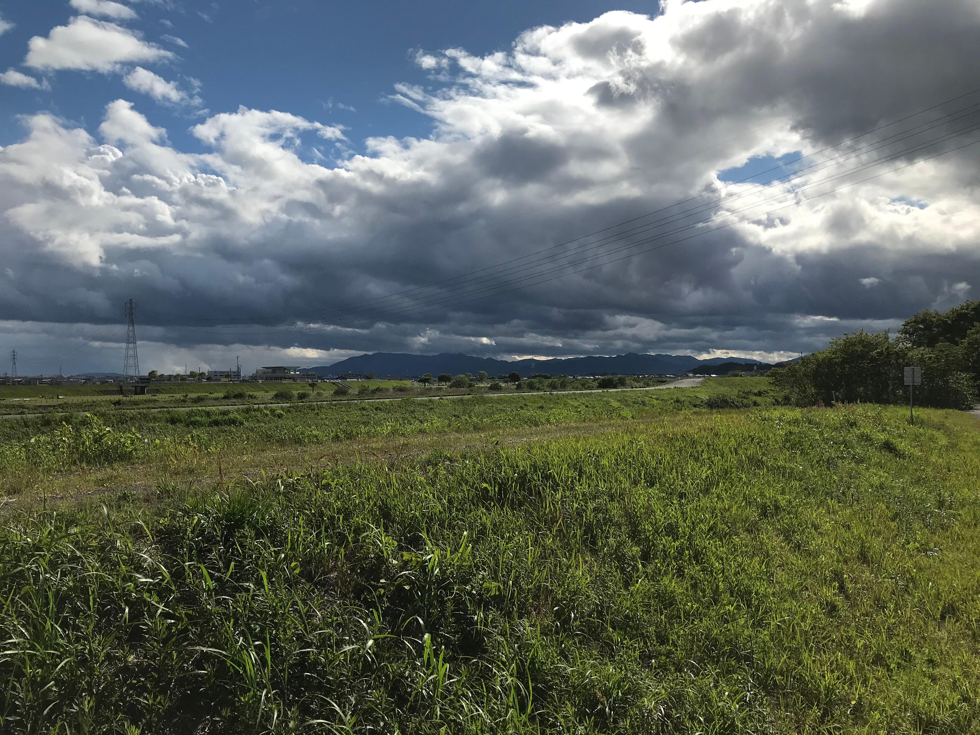
View back towards the mountains from the Suzuka River bank
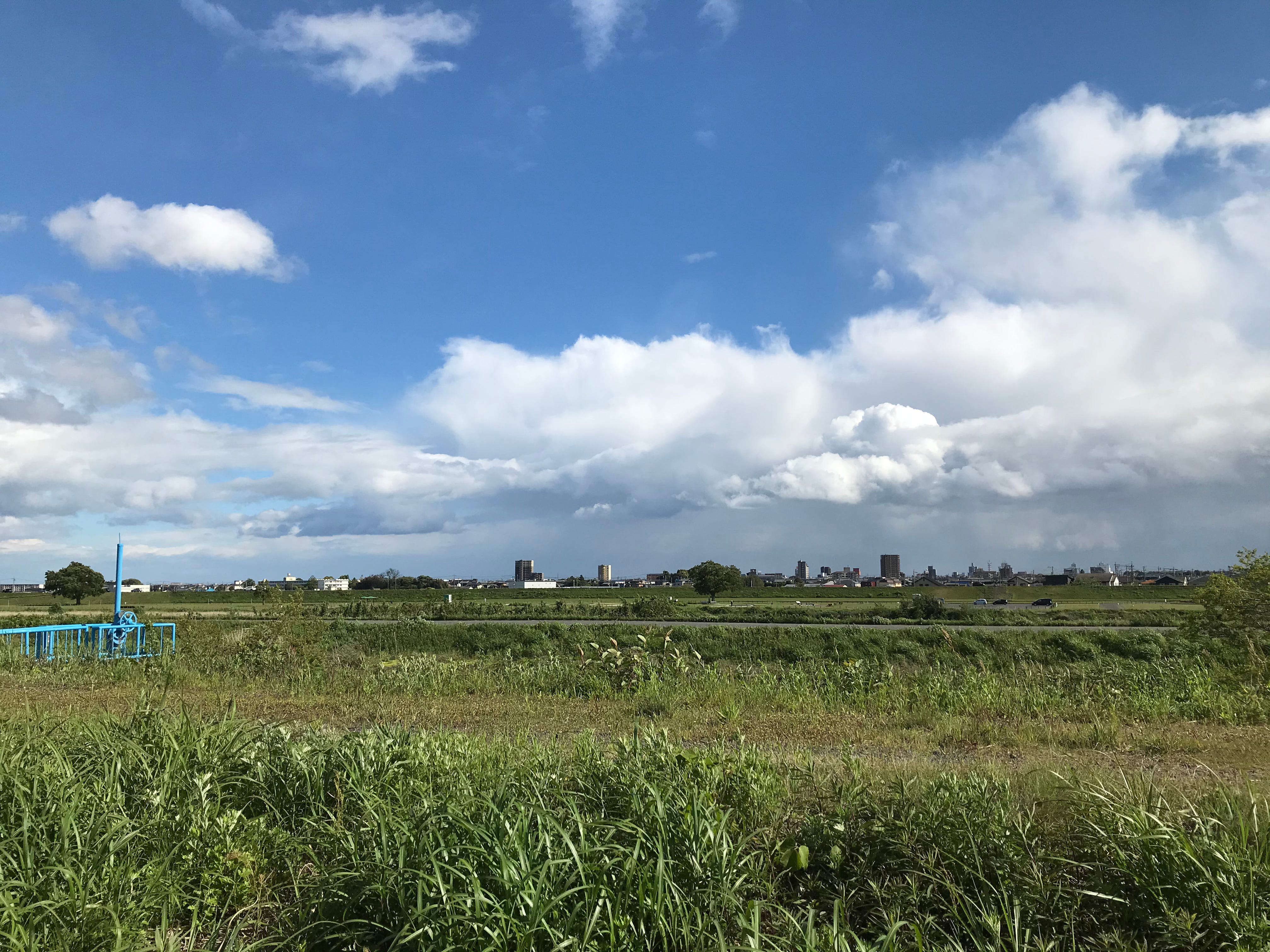
View across to Suzuka City from the Suzuka River bank
For a while, the Tokaido is Route One, running next to the Suzuka River until the pavement breaks away from the road down a strange path as wide as a service road, but with a creeping mat of grass that narrows it to a thin passageway. I wind my way across a patch of farmland and clumps of bamboo towards the long rise of a village.
I pass through a string of long, strung-out villages, old houses lining the narrow road, but Route One is still close. When I meet it again, I find a small rest stop, a little shelter with a tree trunk table and wooden benches under a pyramid roof. I really could do with a pee, and the long miles through housing haven’t given me a chance to go. There’s a kind of shrine thing at one end of the rest area, but it doesn’t look like a proper shrine. Behind, I’m hidden from the road, and there’s a convenient ditch to piss into. I hope it’s not sacrilegious, but I guess I’m peeing off sacred ground.
When I crest a rise, I can see the lights and stacks of the oil refineries in Yokkaichi ahead. Once again, the Tokaido peels away from Route One. Walking past a park, which I’m looking at wondering if I could camp there, a little boy greets me. I shout and wave hello as I walk away. Outside of mechanical convenience store interactions, it’s the first human interaction of my day. The Corona pandemic is in full swing. Whereas at the beginning of this walk, I would occasionally see people walking the Tokaido (usually the other way), now, I see no one.
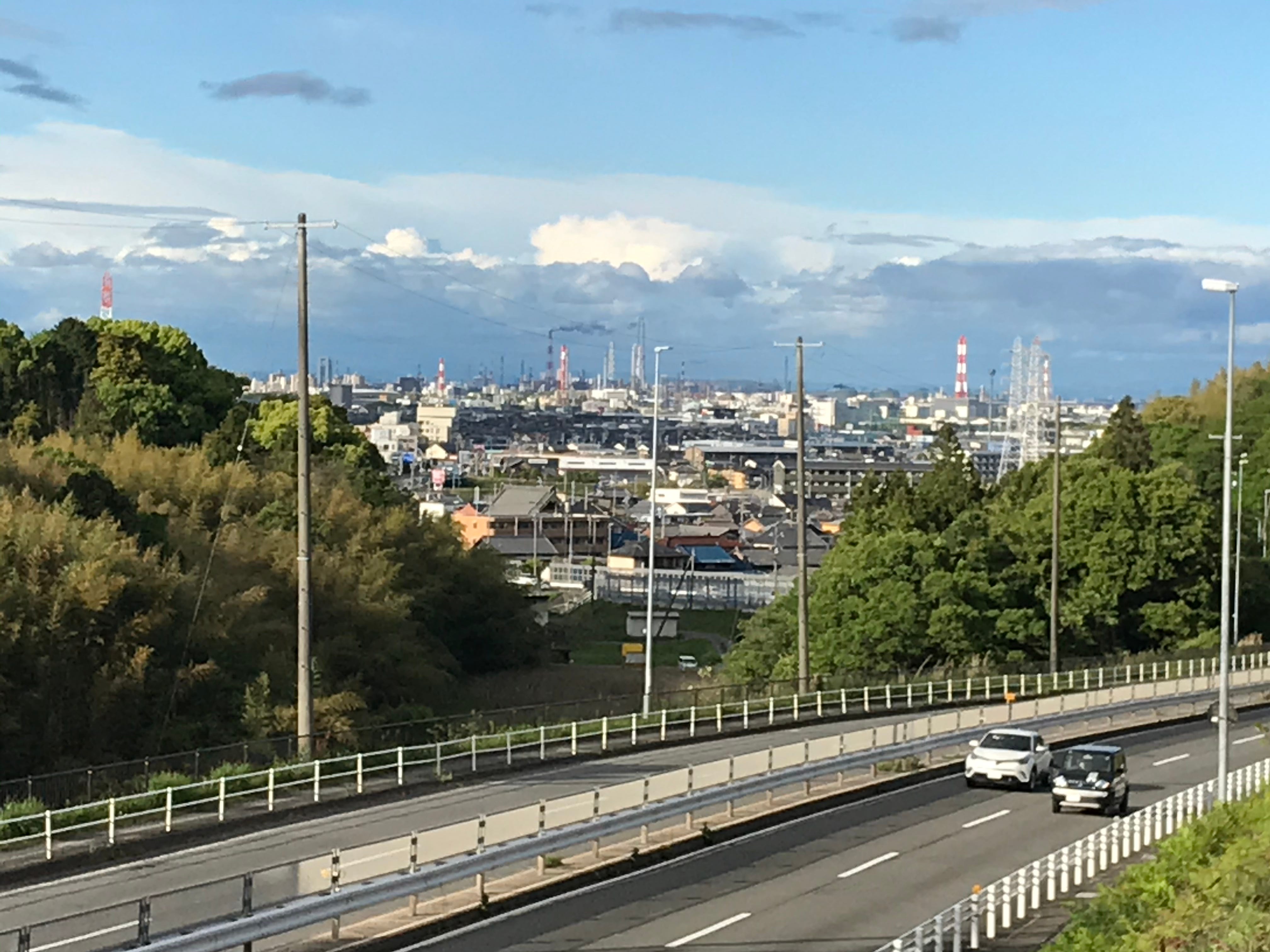
View across Route One towards the oil refineries of Yokkaichi City
As I drop down the hill towards the Utsuba River, I’m on the lookout for somewhere to camp. I’m guessing the river will be the best place. There’s still a while before the sun sets. I walk up one side of the river, then down the other, looking for the best place. What if there’s a rain storm in the mountains and the river level suddenly rises? There’s a lot of construction work going on around the river banks. What if I get run over in the middle of the night by construction equipment? One one side, a ridge of forest-covered hills come right up to the riverside. What if animals, like wild boar, come down to the river? As darkness finally falls, I opt for the gravelly riverbed, close to the riverbank. It’s dry, there won’t be any centipedes here, it clearly hasn’t flooded for a long time, and the houses on the other side of the bank mean it’s unlikely animals will come here to drink. It’s quite close to the Route One bridge over the river. On the one hand, this means the roaring and hissing of trucks carries clearly over the water, on the other, civilization seems close and makes it seem a little less scary.
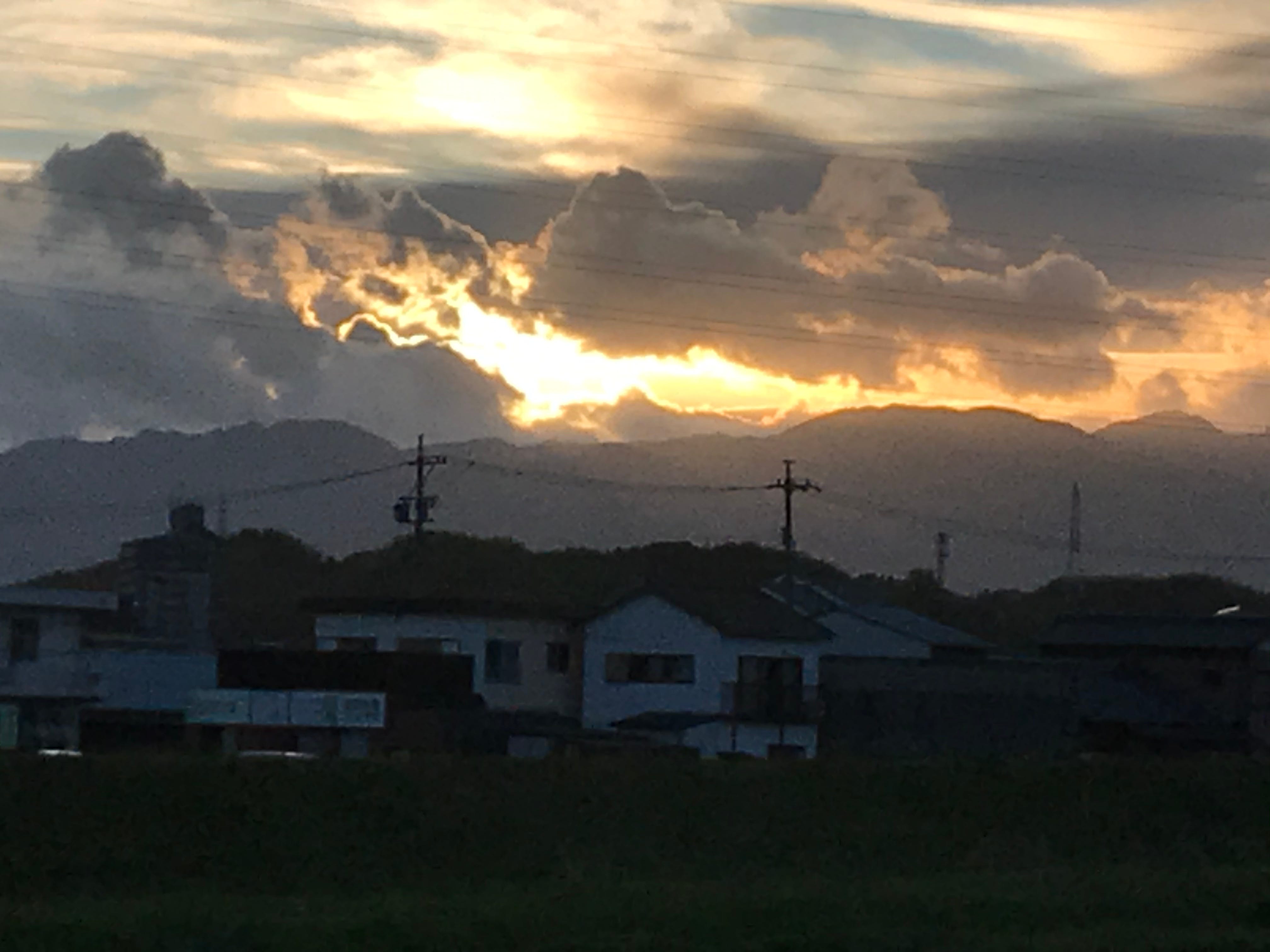
The sun about to disappear behind the mountains - view from the Utsube River - my rest stop for tonight
I set the bivvy bag up for the first time in the almost-dark. I have no sleeping bag, reasoning it won’t be cold enough to need one, and it’s too bulky to carry. But as the night wears on, the wind gusts up the river valley from the sea, and I’m freezing. I resort to putting on all the clothes I’m carrying - extra socks, coat, thermal underwear - the lot. But it’s exciting, I can see the stars, and as I gaze up, the clouds scudding across give the illusion the stars are moving. Sometimes, a dog walker passes on the bank-top road above, torch-light bobbing, but never at my bivvy bag. I have a midnight feast of convenience store chocolate and snacks, it feels like scout camping all those years ago.
So how was it sleeping in a bivvy bag? Do you recommend it?
When I travelled around Japan in August 2019 I only took a sleeping bag with me and spent the night on a couple of beaches. As you wrote, seeing the stars (and the planes flying toward Tokyo, one after another) was pretty exciting.
My wife was afraid I would be beaten up by some oyaji-hunting youth by I had no problems.