


Plain Walking
From Kumamoto City to Uto along the Kyushu Shizen Hodo

With Kumano Kodo on hold until unpacking and rediscovery commences, it’s time to take a trip to Kumamoto City, where I had a couple of days after a job interview to do some hiking.
The network of Shizen Hodo that unite Japan with a series of long-distance walking trails continue across the island of Kyushu. Having walked parts of the Kinki Shizen Hodo and Chubu Shizen Hodo, it was time to try out the Kyushu Shizen Hodo. My experience on the former had taught me not to follow the connecting routes across plains too carefully, and that they would be poorly signposted to boot, but the parts of the route across mountains would be carefully maintained and signposted.
A section of the Kyushu Shizen Hodo runs past Kumamoto City and across the Uto Peninsula, a narrow jut of land stretching out into the Ariake Sea that separates the Kyushu mainland from the islands and peninsulas of Nagasaki.
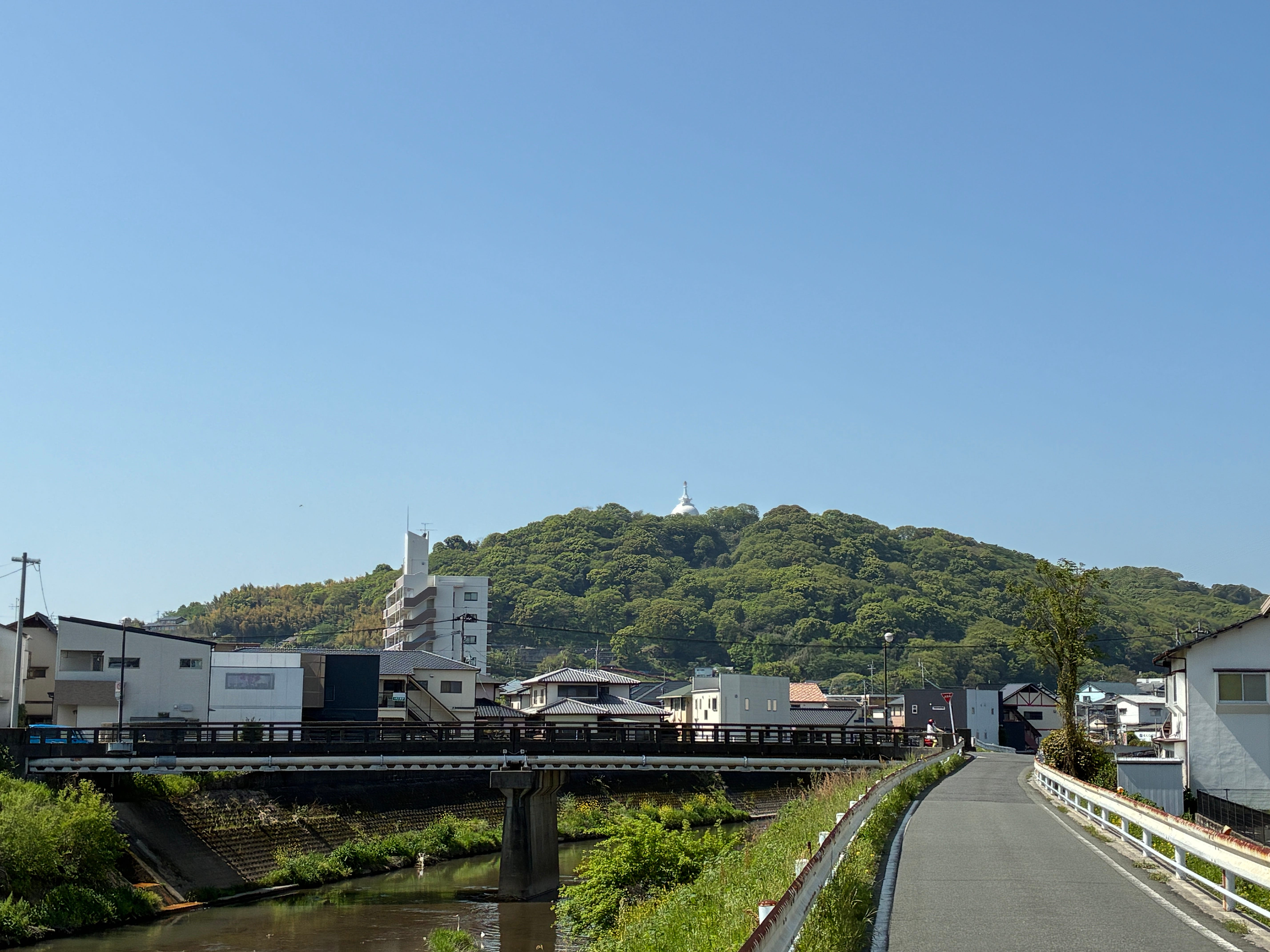
It was this trail that I followed one sunny morning, leaving Kumamoto City along the Iseri River and aiming for the white Indian-temple-style dome of Hanaokayama Park, where it rose from the trees ahead. The river though, curved around the park, and left the city behind.
Spring was in full bloom. Swathes of yellow broom, white chervil, cleavers, mugwort and vetch had burst forth. In England the cleavers/goose-grass/sticky-willy/call-it-what-you-want, I’m pretty sure they last all summer. But in Japan, they come, they’re everywhere, and then along with the karasu no endou (whistle-pea) vetch they disappear, subsumed by other vegetation that can survive the higher temperatures and higher humidity of a Japanese summer. The vetch at least announces its departure with blackened seed pods, but the cleavers just seem to slowly vanish.
I was on the lookout for what was different from mainland Honshu, and all I could come up with so far were more false nettles than I had seen up north. Now, the Iseri River met the Tsuboi River, and at the confluence, I crossed them and headed straight south across the alluvial plain that separates Kumamoto City from the Uto Peninsula. I could already see the mountains of the peninsula ahead.
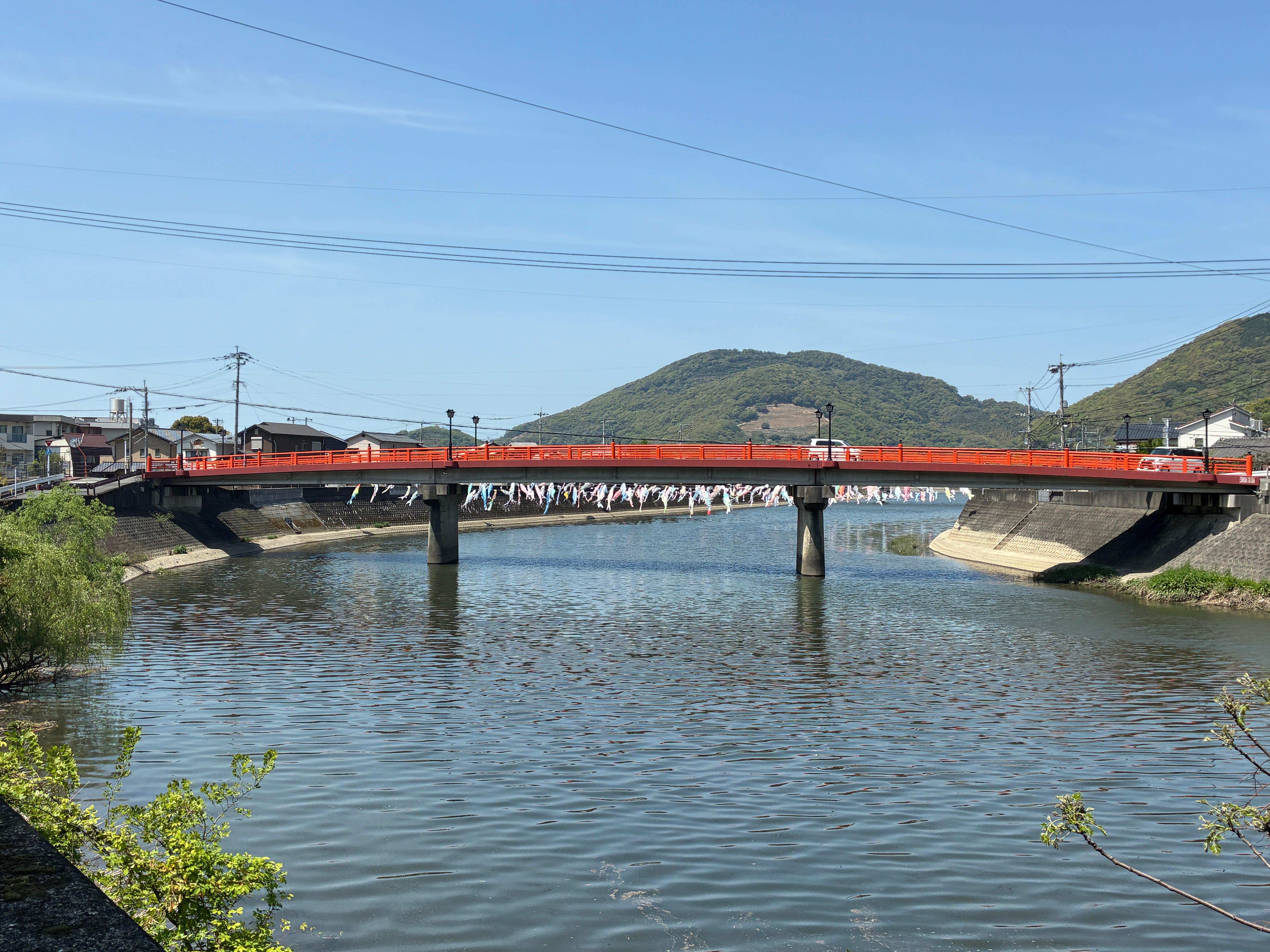
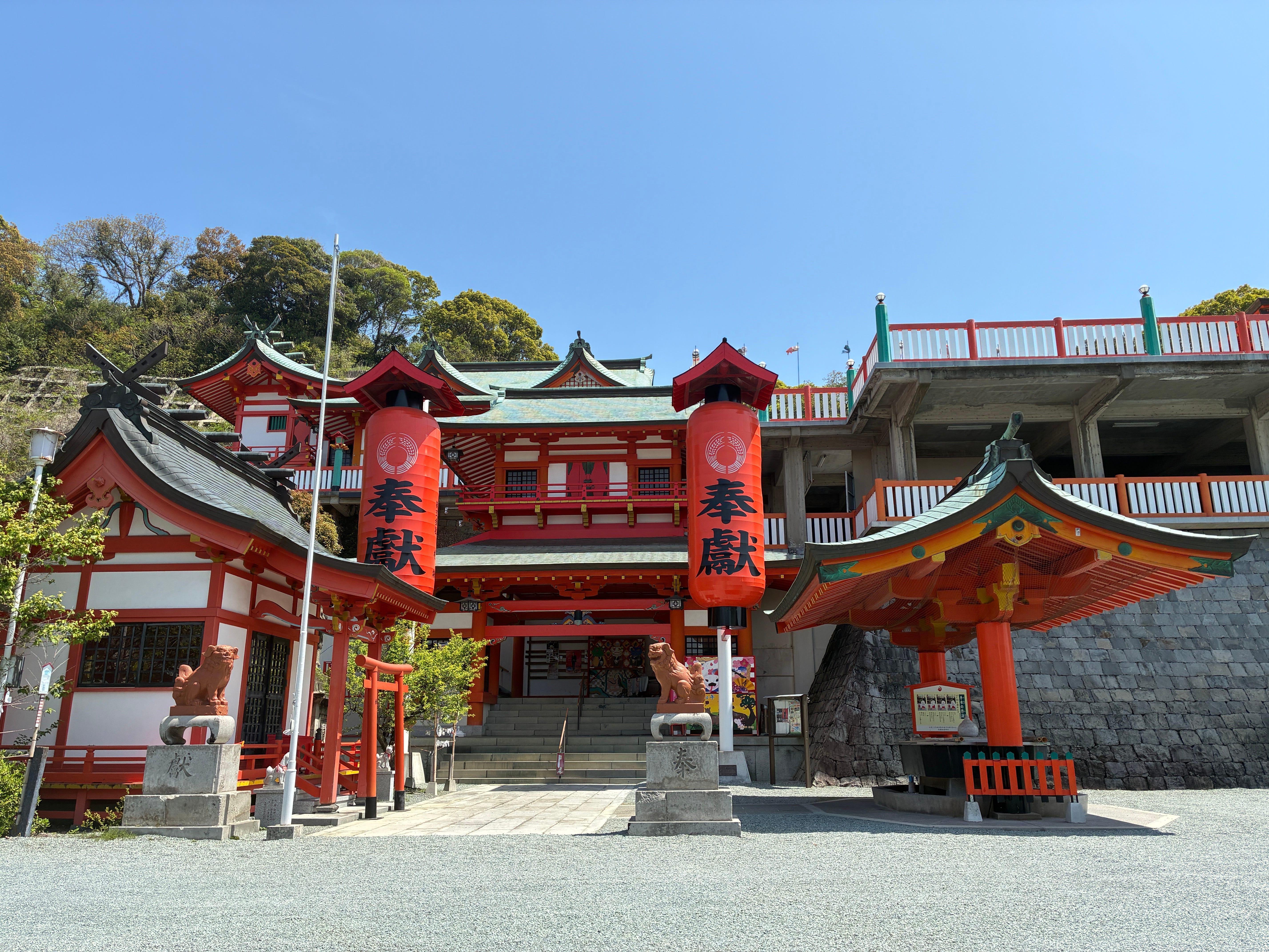
Stretching across the river were the remains of koi-nobori hung out for Children’s Day. On the far side of the river was a small hill upon which were the ruins of a castle. I couldn’t see any way up to get to the ruins, and anyway I realised I had no sunscreen, and I was really going to need sunscreen today. A detour to a conbini later, I returned, sunscreened and ready to continue south. The garishly-bright shrine at the foot of the hill with the castle ruins had the only Kyushu Shizen Hodo map I would see all day, a faded-wooden affair on which the genzaichi “You are here” marker was no longer visible.
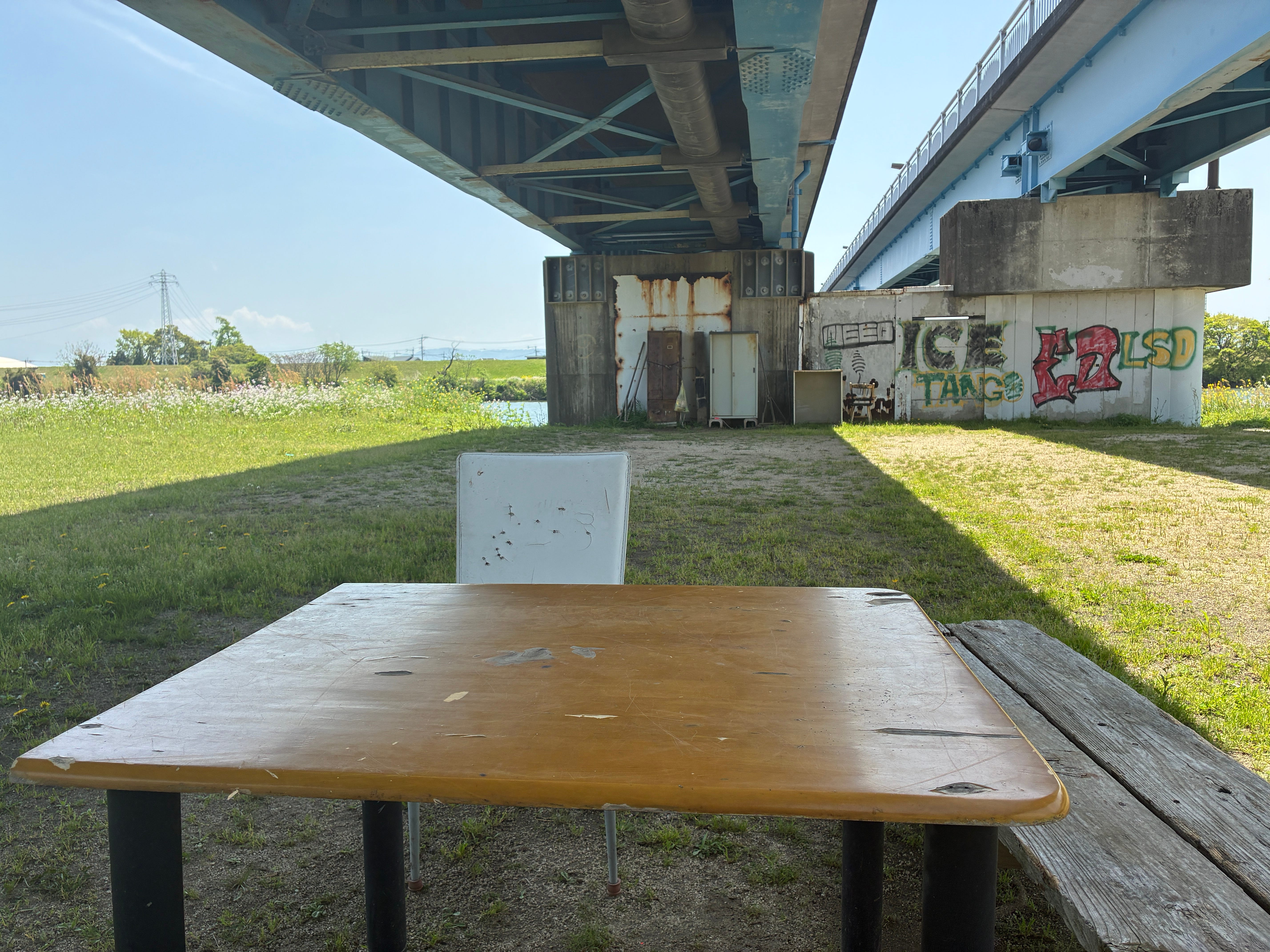
Across the plain. Rectangle fields. Rectangle reservoirs. Rectangles of new housing. Rectangles of vinyl housing. The smell of oilseed rape and the drone of a plane doing aerobatics. And all the while, the sun beating down. Finally, I reached the Shirakawa, the largest of the rivers that passes through the centre of Kumamoto City. Under a road-bridge, I rested on some battered old chairs and tables. Some boys cycling to an after-school sports club spotted me and enthusiastically shouted “Hello!” This felt like the Japan of twenty years ago! Kobe teens had long since grown used to the sight of foreigners, but here, I was still a celebrity.
Back across the big brown plain. In some rectangles the earth was newly turned, the soil in fine, neat, level rows, ready for vegetables, wheat or barley. In some, the surface was like a chocolate brownie fresh out of the oven, moist and cracked, and well, not ready to eat, but certainly ready to be planted with rice seedlings. Now and then, I got wafts of bottom slime from drainage channels.


The fields were interspersed with new housing. New blocks were everywhere for those Kumamoto residents that wished for more space and bigger, better houses. Along the main roads, small restaurants with odd combinations of food like “Rare Cheese and Cookies” and “Burger and Cheesecake”. Whoever had picked the route for this part of the shizen hodo had once again done a magnificent job of selecting the least-appropriate road to direct it down. A main road with no sidewalk so the walker has to relentlessly dodge traffic while there’s a perfectly set of quiet parallel roads across the flatland? But of course! As soon as I was able, I diverted off onto one of these parallel roads and enjoyed a quieter, more scenic, less am-I-about-to-die? walk.
It felt, somehow, like the Po Valley in Italy. And yet, I’ve barely been to the Po Valley. There was something a little Mediterranean in the cypress trees and tall hedges surrounding the farms. Something that reminded me of a book I had read in childhood - “I am David”, where the young hero is tramping across Europe to find his mother, but it is so long since I read the book, I can’t exactly place the memory trigger. As I was doing this walk, I was reading Chris Arnade’s account of his walk across the Po Valley, so this may have helped spark the connection too.
Now, I tabbed around fields of barley, patterns of light and shade danced across their ever-shifting ears. Over them, a skylark flew into the wind and sang as loud as it could. It felt like spring, and at the same time, like an English Indian summer, the hazy sunshine, the not quite actual-summerness of it.
Another river, this time the Midorikawa, that curves south, away from Kumamoto City and into the great range of mountains that separate Kumamoto from Kagoshima. Then, I began to wind my way into the town of Uto. It had more to see than I expected, but I was dog-tired from a day of plain walking. I needed shade, a cool cocoa from a vending machine, and to rest my feet. Tomorrow, I would continue.

As usual, I very much enjoyed your prose.
What's the title of that book about the Po valley? Is it good?
Nice. I like river walks , will try to Google this route.